Click here to view map full screen. Google Street View is available on some of the trails along with Photo Spheres at various locations. To use Street View, open Google Maps in a new browser tab and search for Zion Canyon Scenic Drive.
Took the shuttle to the Weeping Rock stop and hiked up to Hidden Canyon. This is very narrow canyon that is located about 850 feet above the canyon floor, The entrance is not visible from below.
Looking down on the Virgin River as I start the climb up.

Weeping Rock is the dark spot at the bottom of the far cliff.

A fun part of the trail. I would not want to try and pass anyone coming from the other direction.

The beginning of Hidden Canyon.


This was my turnaround point. As interesting as the canyon is, your views are limited to two high walls about 20-30 feet apart and I wasn't interested in scrambling up the log on the right to continue.

When I was looking down on the river I noticed a trail down to the river and decided to check it out. This turned out to be a very pleasant and quiet hike all the way to the end of the road with fantastic views of the canyon walls. I tried to take some panorama pictures but they just didn't come out.
A tom turkey flew across the river a few yards in front of me


Beavers in Zion Canyon were a surprise to me. According to a park ranger, they burrow into the side of the river banks behind brush to make their dens. No beaver dams in Zion.


The very popular Riverside Walk trail starts at the end of the road and goes to the river crossing for the start of the trail to The Narrows. This was my turnaround point.

View of the unofficial trail along the river.

The next day Blue and Sly went back to play at Doggy Dude Ranch and I headed out to the trailhead for Angels Landing. This is a very popular hike and you can actually use Google Street View to "hike" almost the entire West Rim Trail up to the beginning of the Angels Landing Trail that goes along the ridge to the top of Angels Landing. Several Photo Spheres are available along this trail and provide a better view than any of my pictures. Here's a good one, rotate if necessary to see the narrow section of ridge that the trail crosses. There are many narrow places along the trail with chains attached to the rock and only enough room for one-way traffic. On a busy day, like today, you can get stuck in one place for several minutes waiting for all the people, from the other direction, to pass.
A view of Angels Landing from the trail. Angels Landing is almost 1,500 feet high and the rock faces are about 1,200 feet high.

Starting the climb, can you see the trail?

Looking down at the trail.

I went past the trail for Angels Landing to get a picture of the ridge that the trail follows. The white squares in the lower right of the picture are the toilets near the start on the ridge trail. Many people were sitting around this area, I'm guessing they were waiting for the more adventurous in their party that went to Angels Landing. This not a trail for everyone. It takes about 40 minutes to reach the top.

A zoomed in shot, can you see the people on the trail?

On the trail up

At top looking down the canyon.
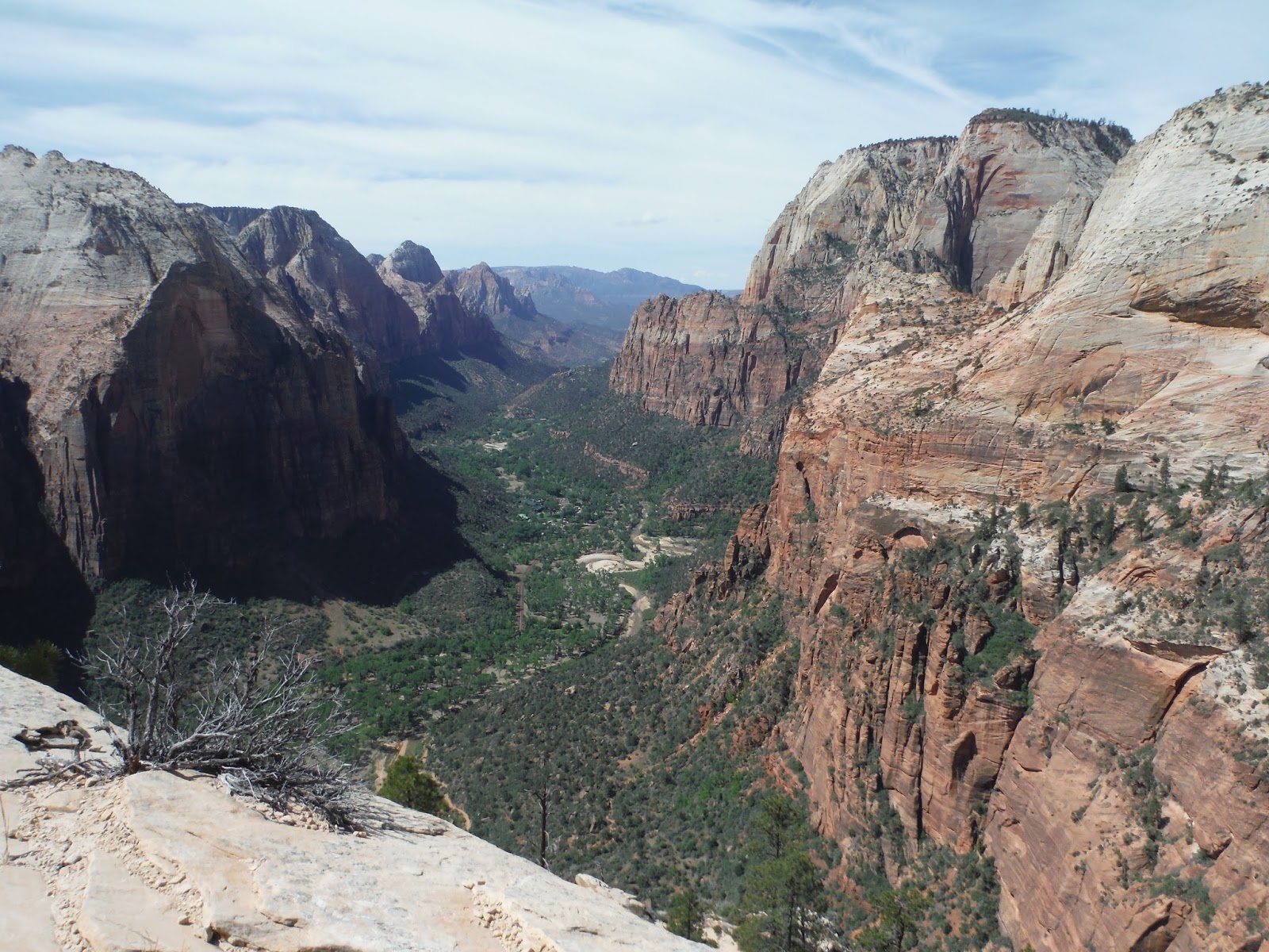
Looking up the canyon.

On the way back down the trail. The ridge and canyon wall blend together in this picture. Here's another photo sphere a little farther down the tail. The gap between the canyon wall and the ridge is easier to see. The trail from the canyon floor is at the bottom of the gap.

After Angels Landing, I took the shuttle back to the campground and then hiked up The Watchman Trail. The sun was coming out and the temperature was getting quite hot in the gully on the way up. This trail goes to a small plateau with a good view of The Watchman. Here's a good photo sphere.
Looking up the valley.
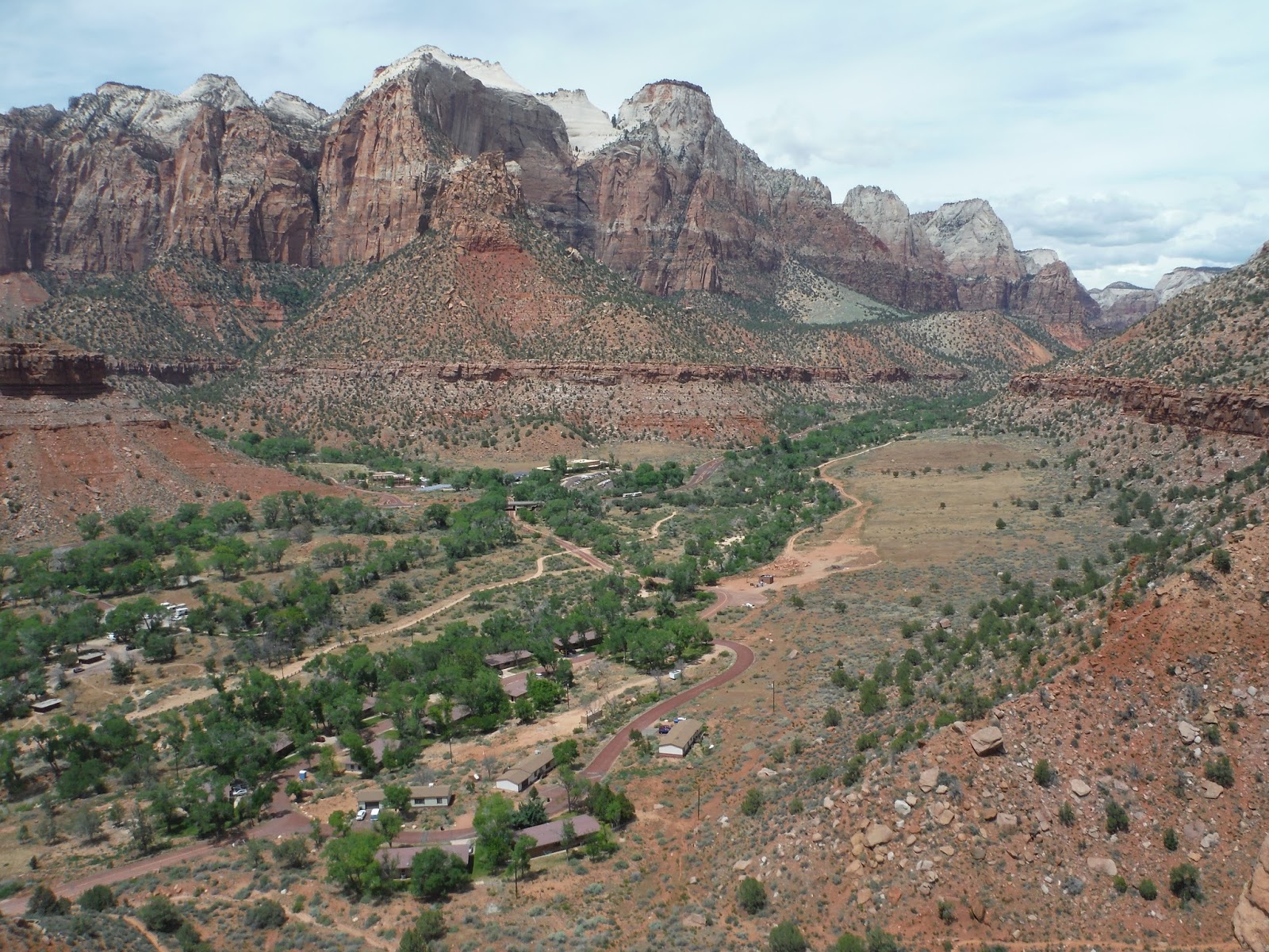
View of the campgrounds.

On the way down, I spotted a deer looking for that perfect rest spot.


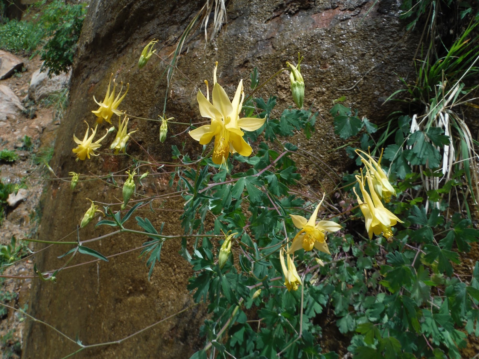
It was wildflower time at Zion.


pub 3/25/2016
No comments:
Post a Comment